Geolocate

Farlow topographic map

Click on the map to display elevation.

About this map

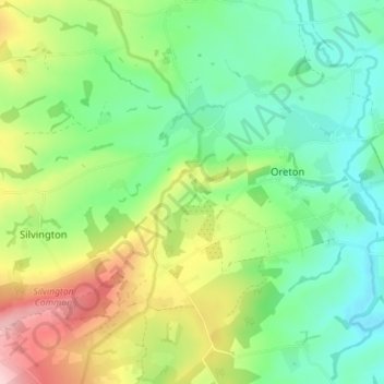
Name: Farlow topographic map, elevation, terrain.

Location: Farlow, Oreton, Shropshire, England, United Kingdom (52.40350 -2.56825 52.43654 -2.49731)

Average elevation: 194 m

Minimum elevation: 118 m

Maximum elevation: 339 m

Shropshire trails, hiking, mountain biking, running and outdoor activities

Gear up for your next adventure:

🪓Outdoor Multitools - Versatile tools for hiking and camping
🧣Fleece Neck Warmers - Extra insulation for winter topographic surveys
📷Camera Straps - Secure straps for carrying cameras while walking
📍Handheld GPS Navigators - Reliable satellite navigation for hiking and off-road exploration
🥾Walking Shoes - Lightweight walking shoes for countryside and coastal paths

As an Amazon Associate, this site earns from qualifying purchases at no extra cost to you.