Geolocate

Gherla topographic map

Click on the map to display elevation.

About this map

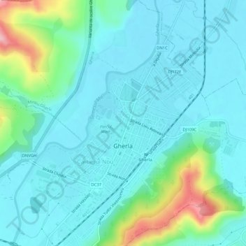
Name: Gherla topographic map, elevation, terrain.

Location: Gherla, Cluj, 405300, Romania (47.01719 23.87348 47.04685 23.92501)

Average elevation: 280 m

Minimum elevation: 245 m

Maximum elevation: 428 m

Gear up for your next adventure:

🧣Neck Gaiters - Protects against wind and sun on exposed ridges and peaks
🔋Power Banks - Portable chargers for long outdoor trips
🔥Reusable Hand Warmers - Maintain dexterity in your fingers for precise map handling
🧭Professional Hiking Compasses - High-precision liquid-filled compasses for map reading and orientation
🧥Breathable Waterproof Jackets - Essential rain protection for the unpredictable British climate

As an Amazon Associate, this site earns from qualifying purchases at no extra cost to you.