
Make a donation
Gear up for your next adventure:
As an Amazon Associate, this site earns from qualifying purchases at no extra cost to you.
Poperinge topographic map
Click on the map to display elevation.
Make a donation
Gear up for your next adventure:
As an Amazon Associate, this site earns from qualifying purchases at no extra cost to you.
Poperinge
Poperinge ligt in Zandlemig Vlaanderen op een hoogte van ongeveer 25 meter. Het is gelegen in het dal van de Vleterbeek, welke in noordoostelijke richting overgaat in de Poperingevaart. Langs de Poperingevaart bevindt zich het Burggraaf Frimoutpark.
Make a donation
Gear up for your next adventure:
As an Amazon Associate, this site earns from qualifying purchases at no extra cost to you.
About this map
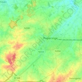
Name: Poperinge topographic map, elevation, terrain.
Location: Poperinge, Ieper, West-Vlaanderen, 8970, België (50.81343 2.65805 50.89190 2.78263)
Average elevation: 28 m
Minimum elevation: 6 m
Maximum elevation: 65 m
Make a donation
Gear up for your next adventure:
As an Amazon Associate, this site earns from qualifying purchases at no extra cost to you.