
東桜一丁目 topographic map
Interactive map
Click on the map to display elevation.
About this map
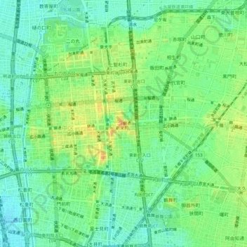
Name: 東桜一丁目 topographic map, elevation, terrain.
Location: 東桜一丁目, 東区, Nagoya, Préfecture d'Aichi, 461-0005, Japon (35.15002 136.89195 35.19002 136.93195)
Average elevation: 16 m
Minimum elevation: 1 m
Maximum elevation: 38 m