
Tredós topographic map
Interactive map
Click on the map to display elevation.
About this map
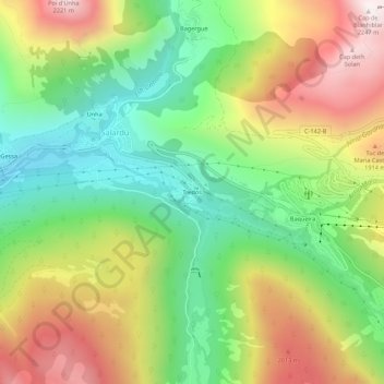
Name: Tredós topographic map, elevation, terrain.
Location: Tredós, Naut Aran, Val-d'Aran, Lérida, Catalogne, 25539, Espagne (42.68203 0.89594 42.72203 0.93594)
Average elevation: 1,641 m
Minimum elevation: 1,200 m
Maximum elevation: 2,235 m