
Río Muniellos topographic map
Interactive map
Click on the map to display elevation.
About this map
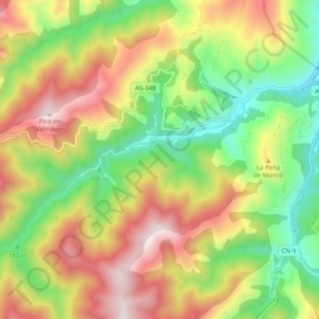
Name: Río Muniellos topographic map, elevation, terrain.
Location: Río Muniellos, Cangas del Narcea, 33811, España (43.02080 -6.70319 43.05621 -6.61706)
Average elevation: 951 m
Minimum elevation: 533 m
Maximum elevation: 1,459 m