
Mogodé topographic map
Interactive map
Click on the map to display elevation.
About this map
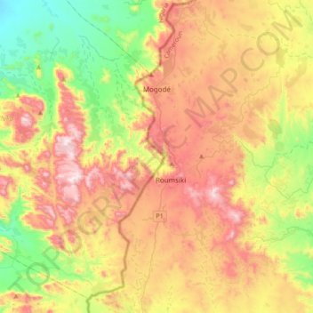
Name: Mogodé topographic map, elevation, terrain.
Location: Mogodé, Mayo-Tsanaga, EN, Cameroun (10.37244 13.53061 10.70137 13.76879)
Average elevation: 843 m
Minimum elevation: 467 m
Maximum elevation: 1,296 m