
Caguba topographic map
Interactive map
Click on the map to display elevation.
About this map
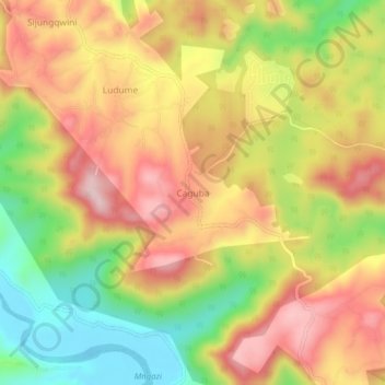
Name: Caguba topographic map, elevation, terrain.
Average elevation: 160 m
Minimum elevation: -5 m
Maximum elevation: 296 m
Other topographic maps
Click on a map to view its topography, its elevation and its terrain.
Port St Johns
South Africa > Eastern Cape > O.R. Tambo District Municipality > Port St Johns Local Municipality
Port St Johns, Port St Johns Local Municipality, O.R. Tambo District Municipality, Eastern Cape, South Africa
Average elevation: 85 m