
San Juan de la Maguana topographic map
Interactive map
Click on the map to display elevation.
San Juan de la Maguana
Owing to its location in a sheltered basin, San Juan de la Maguana has a relatively dry tropical savanna climate (Köppen Aw). Maxima are hot year-round, although the city’s moderate altitude lessens humidity somewhat and cools the mornings by around 4 to 5 °C (7 to 9 °F). There is a very pronounced dry season from December to March, when only 76.9 millimetres or 3.03 inches of rain can be expected, and a moderate wet season covering the remainder of the year
About this map
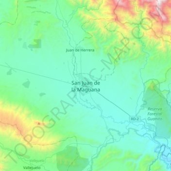
Name: San Juan de la Maguana topographic map, elevation, terrain.
Location: San Juan de la Maguana, San Juan, Dominican Republic (18.64681 -71.38770 18.96681 -71.06770)
Average elevation: 676 m
Minimum elevation: 279 m
Maximum elevation: 2,500 m