
Thank you for supporting this site ❤️
Make a donation
Make a donation
Gear up for your next adventure:
As an Amazon Associate, this site earns from qualifying purchases at no extra cost to you.
Chiephobozou topographic map
Click on the map to display elevation.
Thank you for supporting this site ❤️
Make a donation
Make a donation
Gear up for your next adventure:
As an Amazon Associate, this site earns from qualifying purchases at no extra cost to you.
About this map
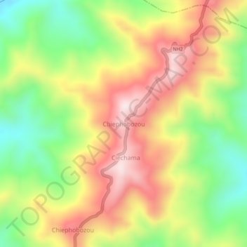
Name: Chiephobozou topographic map, elevation, terrain.
Location: Chiephobozou, Kohima District, Nagaland, 797105, India (25.79482 94.11957 25.83482 94.15957)
Average elevation: 1,189 m
Minimum elevation: 919 m
Maximum elevation: 1,463 m
Thank you for supporting this site ❤️
Make a donation
Make a donation
Gear up for your next adventure:
As an Amazon Associate, this site earns from qualifying purchases at no extra cost to you.