
Saint-Martin topographic map
Interactive map
Click on the map to display elevation.
About this map
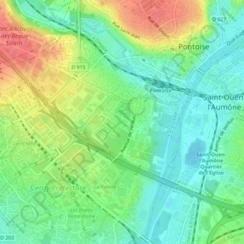
Name: Saint-Martin topographic map, elevation, terrain.
Average elevation: 45 m
Minimum elevation: 20 m
Maximum elevation: 85 m
Other topographic maps
Click on a map to view its topography, its elevation and its terrain.
Centre-Ville
France > Ile-de-France > Pontoise
Centre-Ville, Pontoise, Val-d'Oise, Ile-de-France, Metropolitan France, 95300, France
Average elevation: 48 m