
Thank you for supporting this site ❤️
Make a donation
Make a donation
Gear up for your next adventure:
As an Amazon Associate, this site earns from qualifying purchases at no extra cost to you.
Pichari topographic map
Click on the map to display elevation.
Thank you for supporting this site ❤️
Make a donation
Make a donation
Gear up for your next adventure:
As an Amazon Associate, this site earns from qualifying purchases at no extra cost to you.
About this map
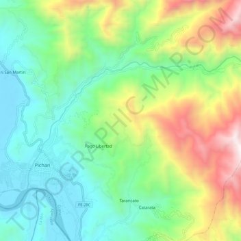
Name: Pichari topographic map, elevation, terrain.
Location: Pichari, Provincia de La Convención, Cuzco, Perú (-12.53092 -73.83483 -12.46980 -73.72556)
Average elevation: 1,149 m
Minimum elevation: 530 m
Maximum elevation: 2,474 m
Thank you for supporting this site ❤️
Make a donation
Make a donation
Gear up for your next adventure:
As an Amazon Associate, this site earns from qualifying purchases at no extra cost to you.