
Akhaltsikhe topographic map
Interactive map
Click on the map to display elevation.
Akhaltsikhe
The highland environment between Akhaltsikhe and Aspindza presents a varied and complex array of archaeological features in different locations, elevations and topographies. This includes the alluvial flood-plain of the Kura River, all the way to the high grasslands.
About this map
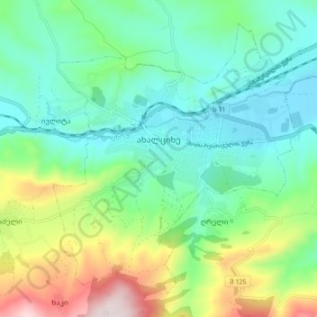
Name: Akhaltsikhe topographic map, elevation, terrain.
Average elevation: 1,123 m
Minimum elevation: 944 m
Maximum elevation: 1,575 m
Other topographic maps
Click on a map to view its topography, its elevation and its terrain.