
Los Palmitos topographic map
Interactive map
Click on the map to display elevation.
About this map
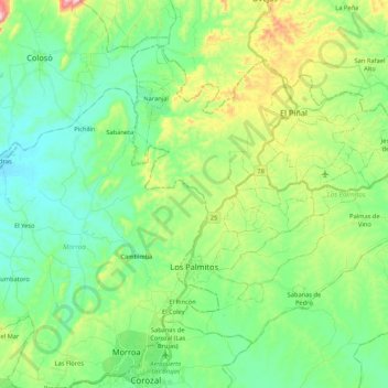
Name: Los Palmitos topographic map, elevation, terrain.
Location: Los Palmitos, Sabanas, Sucre, RAP Caribe, Kolumbien (9.33916 -75.30256 9.50115 -75.08960)
Average elevation: 180 m
Minimum elevation: 71 m
Maximum elevation: 462 m
Other topographic maps
Click on a map to view its topography, its elevation and its terrain.
Las Llanadas
Las Llanadas, Sampués, Montes de María, Sucre, RAP Caribe, Kolumbien
Average elevation: 116 m