
Blauwe Nijl topographic map
Interactive map
Click on the map to display elevation.
About this map
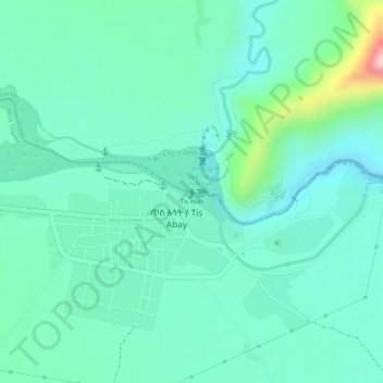
Name: Blauwe Nijl topographic map, elevation, terrain.
Location: Blauwe Nijl, ጥስ እሳት / Tis Abay, West Gojjam, Amhara, Ethiopië (11.48794 37.58689 11.48795 37.58695)
Average elevation: 1,648 m
Minimum elevation: 1,590 m
Maximum elevation: 1,836 m