
Sanathnagar Industrial Estate Park topographic map
Interactive map
Click on the map to display elevation.
About this map
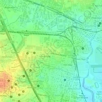
Name: Sanathnagar Industrial Estate Park topographic map, elevation, terrain.
Average elevation: 543 m
Minimum elevation: 525 m
Maximum elevation: 566 m
Other topographic maps
Click on a map to view its topography, its elevation and its terrain.
musi
India > Telangana > Balanagar mandal > Hyderabad
musi, Greater Hyderabad Municipal Corporation North Zone, Hyderabad, Balanagar mandal, Medchal–Malkajgiri, Telangana, 500080, India
Average elevation: 524 m