
Schloß Holte-Stukenbrock topographic map
Interactive map
Click on the map to display elevation.
About this map
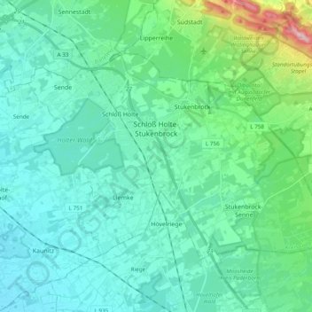
Name: Schloß Holte-Stukenbrock topographic map, elevation, terrain.
Average elevation: 132 m
Minimum elevation: 88 m
Maximum elevation: 353 m
Darüber hinaus ist der Holter Wald mit seiner 1000-jährigen Eiche und einem Brusthöhenumfang von 8,15 m (2014) zu nennen.
Other topographic maps
Click on a map to view its topography, its elevation and its terrain.
Verl
Deutschland > Nordrhein-Westfalen > Kreis Gütersloh
Verl, Kreis Gütersloh, Nordrhein-Westfalen, 33415, Deutschland
Average elevation: 93 m
Gütersloh
Deutschland > Nordrhein-Westfalen > Kreis Gütersloh
Gütersloh, Kreis Gütersloh, Nordrhein-Westfalen, Deutschland
Average elevation: 80 m