Geolocate

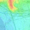
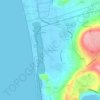
Pimonte topographic map

Click on the map to display elevation.

About this map

Name: Pimonte topographic map, elevation, terrain.

Location: Pimonte, Napoli, Campania, Italy (40.64570 14.49104 40.68783 14.55518)

Average elevation: 646 m

Minimum elevation: 44 m

Maximum elevation: 1,400 m

Other topographic maps

Click on a map to view its topography, its elevation and its terrain.

Sentiero del Grande Cono

Italy > Campania > Napoli > Ercolano

Average elevation: 833 m

Masseria Curato

Italy > Campania > Napoli > Pompei > Masseria Curato

Average elevation: 13 m

Sorgente Acqua Santa

Italy > Campania > Napoli > Pimonte

Average elevation: 985 m

Corricella

Italy > Campania > Napoli > Procida

Average elevation: 6 m

Botanical Garden of Naples

Italy > Campania > Napoli > Naples

Average elevation: 65 m

Nuova Colmata

Italy > Campania > Napoli > Pozzuoli

Average elevation: 23 m

Gear up for your next adventure:

👕Technical Hiking Tees - Moisture-management for high-exertion climbs
📸Action Camera Chest Mounts - Record your ascent following topographic paths hands-free
⌚GPS Outdoor Watches - Watches with GPS tracking for hiking and exploration
🥤Collapsible Water Bottles - Save space in your rucksack as you consume your water
🥼Base Layers - Thermal base layers for temperature regulation

As an Amazon Associate, this site earns from qualifying purchases at no extra cost to you.