
Wheeler Peak topographic map
Interactive map
Click on the map to display elevation.
About this map
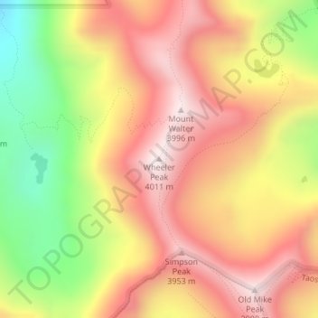
Name: Wheeler Peak topographic map, elevation, terrain.
Average elevation: 3,674 m
Minimum elevation: 3,234 m
Maximum elevation: 3,995 m
Other topographic maps
Click on a map to view its topography, its elevation and its terrain.
Taos
États-Unis d'Amérique > Nouveau-Mexique > Taos County
Taos, Taos County, Nouveau-Mexique, États-Unis d'Amérique
Average elevation: 2,180 m