
Thank you for supporting this site ❤️
Make a donation
Make a donation
Gear up for your next adventure:
As an Amazon Associate, this site earns from qualifying purchases at no extra cost to you.
Lugueros topographic map
Click on the map to display elevation.
Thank you for supporting this site ❤️
Make a donation
Make a donation
Gear up for your next adventure:
As an Amazon Associate, this site earns from qualifying purchases at no extra cost to you.
About this map
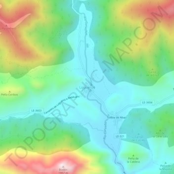
Name: Lugueros topographic map, elevation, terrain.
Location: Lugueros, Valdelugueros, León, Castile and León, 24843, Spain (42.95312 -5.43239 42.99312 -5.39239)
Average elevation: 1,394 m
Minimum elevation: 1,156 m
Maximum elevation: 1,938 m
Thank you for supporting this site ❤️
Make a donation
Make a donation
Gear up for your next adventure:
As an Amazon Associate, this site earns from qualifying purchases at no extra cost to you.