
Todi topographic map
Interactive map
Click on the map to display elevation.
About this map
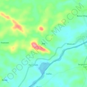
Name: Todi topographic map, elevation, terrain.
Location: Todi, Golakonneh, Grand Cape Mount County, Liberia (7.04682 -10.91870 7.08682 -10.87870)
Average elevation: 98 m
Minimum elevation: 67 m
Maximum elevation: 173 m
Other topographic maps
Click on a map to view its topography, its elevation and its terrain.
Tai
Liberia > Grand Cape Mount County > Golakonneh > Tai
Tai, Golakonneh, Grand Cape Mount County, Liberia
Average elevation: 85 m