
Kuchinarai topographic map
Interactive map
Click on the map to display elevation.
About this map
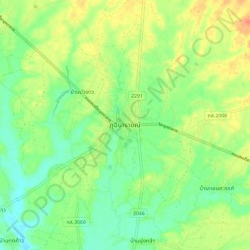
Name: Kuchinarai topographic map, elevation, terrain.
Location: Kuchinarai, Chum Chang, Kalasin Province, 46110, Thailand (16.49768 104.01106 16.57768 104.09106)
Average elevation: 169 m
Minimum elevation: 150 m
Maximum elevation: 194 m
Other topographic maps
Click on a map to view its topography, its elevation and its terrain.
Kalasin
Thailand > Kalasin Province > Kalasin
Kalasin, Kalasin Province, Thailand
Average elevation: 143 m