Geolocate

Le Bois Richet topographic map

Click on the map to display elevation.

About this map
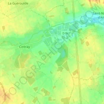
Name: Le Bois Richet topographic map, elevation, terrain.

Location: Le Bois Richet, Cintray, Breteuil, Bernay, Eure, Normandie, France métropolitaine, 27160, France (48.77353 0.88856 48.81353 0.92856)

Average elevation: 174 m

Minimum elevation: 159 m

Maximum elevation: 186 m

Other topographic maps

Click on a map to view its topography, its elevation and its terrain.
Breteuil

France > Normandie > Eure > Breteuil

Average elevation: 180 m

La Guéroulde

France > Normandie > Eure > Breteuil

Average elevation: 179 m

Gear up for your next adventure:

🌄Outdoor Binoculars - Compact binoculars for landscape observation
🥄Titanium Camping Sporks - The ultimate lightweight utensil for trail meals
🚶Walking Pedometers - Simple distance tracking for casual trail walkers
🧗Locking Carabiners - Secure gear to your pack or for light technical use
🍱Food Containers - Reusable containers for outdoor meals

As an Amazon Associate, this site earns from qualifying purchases at no extra cost to you.