
Klüt topographic map
Interactive map
Click on the map to display elevation.
About this map
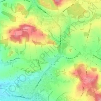
Name: Klüt topographic map, elevation, terrain.
Location: Klüt, Detmold, Kreis Lippe, Nordrhein-Westfalen, Deutschland (51.95315 8.88262 51.98763 8.93253)
Average elevation: 187 m
Minimum elevation: 131 m
Maximum elevation: 252 m
Other topographic maps
Click on a map to view its topography, its elevation and its terrain.
Schling
Deutschland > Nordrhein-Westfalen > Kreis Lippe > Detmold
Schling, Detmold, Kreis Lippe, Nordrhein-Westfalen, 32760, Deutschland
Average elevation: 255 m
Berlebeck
Deutschland > Nordrhein-Westfalen > Kreis Lippe > Detmold
Berlebeck, Detmold, Kreis Lippe, Nordrhein-Westfalen, Deutschland
Average elevation: 296 m