
West Herrington topographic map
Interactive map
Click on the map to display elevation.
About this map
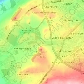
Name: West Herrington topographic map, elevation, terrain.
Average elevation: 88 m
Minimum elevation: 3 m
Maximum elevation: 172 m
Other topographic maps
Click on a map to view its topography, its elevation and its terrain.
New Penshaw
United Kingdom > England > Tyne and Wear > Sunderland > New Herrington
New Penshaw, New Herrington, Sunderland, Tyne and Wear, North East, England, DH4 7NX, United Kingdom
Average elevation: 54 m