
Metyikpwale topographic map
Interactive map
Click on the map to display elevation.
About this map
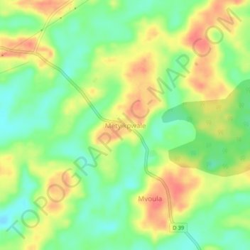
Name: Metyikpwale topographic map, elevation, terrain.
Average elevation: 585 m
Minimum elevation: 558 m
Maximum elevation: 614 m
Other topographic maps
Click on a map to view its topography, its elevation and its terrain.
Nkolandom
Cameroun > Région du Sud > Mvila > Ebolowa II
Nkolandom, Ebolowa II, Communauté urbaine d'Ebolowa, Mvila, Région du Sud, Cameroun
Average elevation: 640 m