
Nazarezinho topographic map
Click on the map to display elevation.
Nazarezinho
Nazarezinho is located on the western part of Paraíba, to the south of Rio Piranhas. Its average elevation is 356 meters above the sea level.
About this map
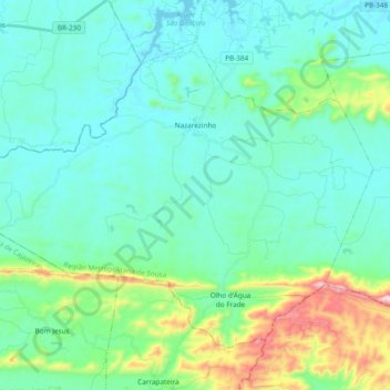
Name: Nazarezinho topographic map, elevation, terrain.
Average elevation: 356 m
Minimum elevation: 244 m
Maximum elevation: 835 m