Geolocate

Cariño topographic map

Click on the map to display elevation.

About this map

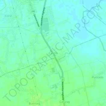
Name: Cariño topographic map, elevation, terrain.

Location: Cariño, Paniqui, Tarlac, Central Luzon, 2307, Philippines (15.62549 120.56985 15.66549 120.60985)

Average elevation: 21 m

Minimum elevation: 16 m

Maximum elevation: 26 m

Gear up for your next adventure:

🧤Waterproof Overmitts - Extreme weather protection for hikers and mountaineers
🍲Portable Camping Stoves - Fast-boiling stoves for hot meals on remote topographic survey trips
🧴Sport Sunscreen Sticks - High-protection sunblock that won't run into your eyes on the trail
🔪Outdoor Multi-Tools - Versatile tools for gear repairs and food prep in the wild
🥾Trekking Poles - Poles to improve stability on uneven terrain

As an Amazon Associate, this site earns from qualifying purchases at no extra cost to you.