Geolocate

Naugsol topographic map

Click on the map to display elevation.

About this map

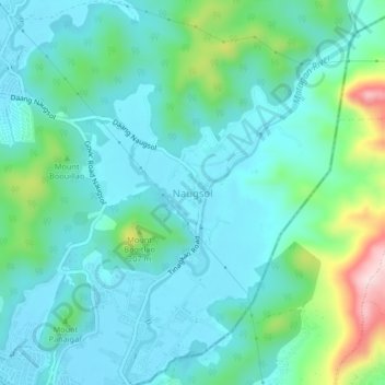
Name: Naugsol topographic map, elevation, terrain.

Location: Naugsol, Subic, Zambales, Central Luzon, 2209, Philippines (14.86000 120.24369 14.90000 120.28369)

Average elevation: 70 m

Minimum elevation: 5 m

Maximum elevation: 320 m

Gear up for your next adventure:

🧥Softshell Jackets - Breathable jackets for active outdoor use
🍱Food Containers - Reusable containers for outdoor meals
🔦Outdoor Torches - Reliable torches for night navigation
📦Dry Bags - Waterproof bags to protect gear from rain
📱Rugged Phone Cases - Heavy-duty protection for smartphones used as secondary GPS tools

As an Amazon Associate, this site earns from qualifying purchases at no extra cost to you.