Geolocate

Jashla topographic map

Interactive map

Click on the map to display elevation.

About this map

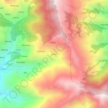
Name: Jashla topographic map, elevation, terrain.

Location: Jashla, Kotkhai, Shimla district, Himachal Pradesh, India (31.14489 77.57032 31.18489 77.61032)

Average elevation: 2,425 m

Minimum elevation: 1,935 m

Maximum elevation: 2,820 m

Other topographic maps

Click on a map to view its topography, its elevation and its terrain.

Gumma

India > Himachal Pradesh > Kotkhai

Gumma, Kotkhai, Shimla, Himachal Pradesh, 171202, India

Average elevation: 1,807 m

Devgarh

India > Himachal Pradesh > Kotkhai

Devgarh, Kotkhai, Shimla district, Himachal Pradesh, 171220, India

Average elevation: 1,925 m