
Guttenberg topographic map
Interactive map
Click on the map to display elevation.
About this map
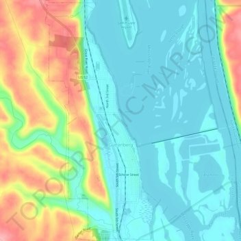
Name: Guttenberg topographic map, elevation, terrain.
Location: Guttenberg, Clayton County, Iowa, United States (42.76827 -91.11838 42.81215 -91.09042)
Average elevation: 218 m
Minimum elevation: 182 m
Maximum elevation: 301 m