Geolocate

Clinton topographic map

Click on the map to display elevation.

About this map

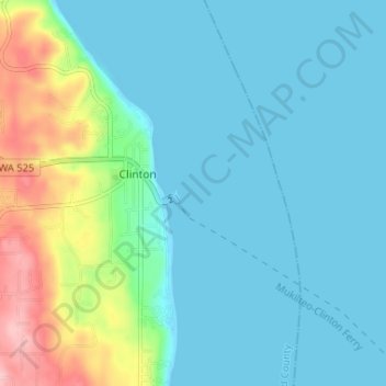
Name: Clinton topographic map, elevation, terrain.

Location: Clinton, Island County, Washington, United States (47.95394 -122.36863 47.99752 -122.32846)

Average elevation: 33 m

Minimum elevation: -1 m

Maximum elevation: 165 m

Gear up for your next adventure:

Insulated Travel Mugs - Keep drinks hot while surveying the landscape from a summit
👕Technical Hiking Tees - Moisture-management for high-exertion climbs
🔭Compact Hiking Binoculars - Lightweight optics for scouting terrain and spotting wildlife
Lightweight Solo Tents - Backpacking tents designed for wild camping in the UK highlands
🧺Microfibre Travel Towels - Fast-drying and compact towels for wild swimming and camping

As an Amazon Associate, this site earns from qualifying purchases at no extra cost to you.