
Glassier topographic map
Interactive map
Click on the map to display elevation.
About this map
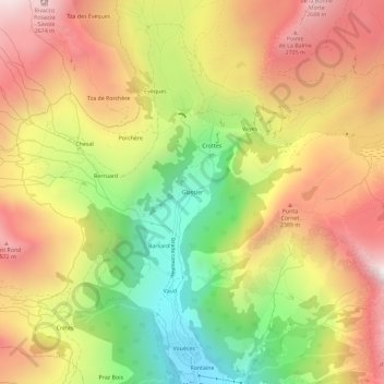
Name: Glassier topographic map, elevation, terrain.
Location: Glassier, Ollomont, Vallée d'Aoste, Italie (45.85400 7.28459 45.89400 7.32459)
Average elevation: 2,081 m
Minimum elevation: 1,381 m
Maximum elevation: 2,722 m
Other topographic maps
Click on a map to view its topography, its elevation and its terrain.
Col de la Bonne mort
Italie > Vallée d'Aoste > Ollomont
Col de la Bonne mort, Ollomont, Vallée d'Aoste, Italie
Average elevation: 2,533 m