
Letham topographic map
Click on the map to display elevation.
About this map
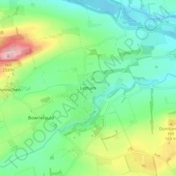
Name: Letham topographic map, elevation, terrain.
Location: Letham, Angus, Scotland, DD8 2PZ, United Kingdom (56.60883 -2.78954 56.64883 -2.74954)
Average elevation: 112 m
Minimum elevation: 58 m
Maximum elevation: 233 m
Angus trails, hiking, mountain biking, running and outdoor activities
Other topographic maps
Click on a map to view its topography, its elevation and its terrain.