
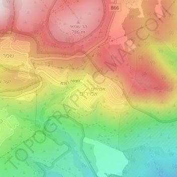
Amirim topographic map
Interactive map
Click on the map to display elevation.
About this map
Name: Amirim topographic map, elevation, terrain.
Average elevation: 512 m
Minimum elevation: 142 m
Maximum elevation: 844 m
Other topographic maps
Click on a map to view its topography, its elevation and its terrain.
Mount Meron
Israel > North District > Merom HaGalil Regional Council
Mount Meron (Hebrew: הַר מֵירוֹן, Har Meron; Arabic: جبل الجرمق, Jabal al-Jarmaq) is a mountain in the Upper Galilee region of Israel. It has special significance in Jewish religious tradition and parts of it have been declared a nature reserve. At 1,204 metres (3,950 ft) above sea level,…
Average elevation: 943 m