
Hanstedt II topographic map
Interactive map
Click on the map to display elevation.
About this map
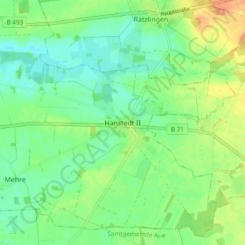
Name: Hanstedt II topographic map, elevation, terrain.
Location: Hanstedt II, Uelzen, Niedersachsen, 29590, Deutschland (52.93805 10.64613 52.97805 10.68613)
Average elevation: 59 m
Minimum elevation: 45 m
Maximum elevation: 79 m
Other topographic maps
Click on a map to view its topography, its elevation and its terrain.
Gansau
Deutschland > Niedersachsen > Uelzen > Hanstedt II > Gansau
Gansau, Hanstedt II, Uelzen, Niedersachsen, 29590, Deutschland
Average elevation: 61 m