
Làng Inao topographic map
Interactive map
Click on the map to display elevation.
About this map
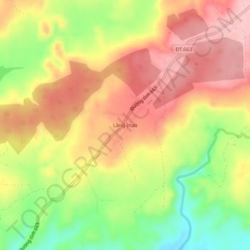
Name: Làng Inao topographic map, elevation, terrain.
Location: Làng Inao, Chư Prông District, Gia Lai Province, Vietnam (13.65552 107.78542 13.69552 107.82542)
Average elevation: 352 m
Minimum elevation: 258 m
Maximum elevation: 424 m
Other topographic maps
Click on a map to view its topography, its elevation and its terrain.