
San Buenaventura (Ventura) topographic map
Interactive map
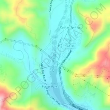
Click on the map to display elevation.
About this map
Name: San Buenaventura (Ventura) topographic map, elevation, terrain.
Average elevation: 163 m
Minimum elevation: 65 m
Maximum elevation: 403 m
Other topographic maps
Click on a map to view its topography, its elevation and its terrain.
San Buenaventura (Ventura)
Estados Unidos de América > California > Ventura County > San Buenaventura (Ventura)
San Buenaventura (Ventura), Ventura County, California, Estados Unidos de América
Average elevation: 158 m