
Pintsch topographic map
Interactive map
Click on the map to display elevation.
About this map
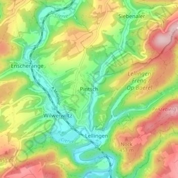
Name: Pintsch topographic map, elevation, terrain.
Location: Pintsch, Kiischpelt, Canton Wiltz, 9767, Luxembourg (49.97365 5.99121 50.01365 6.03121)
Average elevation: 376 m
Minimum elevation: 283 m
Maximum elevation: 498 m