
Strengelbach topographic map
Interactive map
Click on the map to display elevation.
About this map
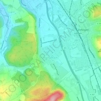
Name: Strengelbach topographic map, elevation, terrain.
Location: Strengelbach, Bezirk Zofingen, Aargau, 4802, Schweiz (47.26452 7.90610 47.29848 7.94083)
Average elevation: 453 m
Minimum elevation: 413 m
Maximum elevation: 577 m