
Thank you for supporting this site ❤️
Make a donation
Make a donation
Gear up for your next adventure:
As an Amazon Associate, this site earns from qualifying purchases at no extra cost to you.
Rovira topographic map
Click on the map to display elevation.
Thank you for supporting this site ❤️
Make a donation
Make a donation
Gear up for your next adventure:
As an Amazon Associate, this site earns from qualifying purchases at no extra cost to you.
About this map
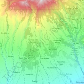
Name: Rovira topographic map, elevation, terrain.
Location: Rovira, Distrito Dolega, Chiriquí, Panama (8.60501 -82.55959 8.77520 -82.46995)
Average elevation: 1,009 m
Minimum elevation: 383 m
Maximum elevation: 2,582 m
Thank you for supporting this site ❤️
Make a donation
Make a donation
Gear up for your next adventure:
As an Amazon Associate, this site earns from qualifying purchases at no extra cost to you.