Geolocate

Kiteni topographic map

Click on the map to display elevation.

About this map

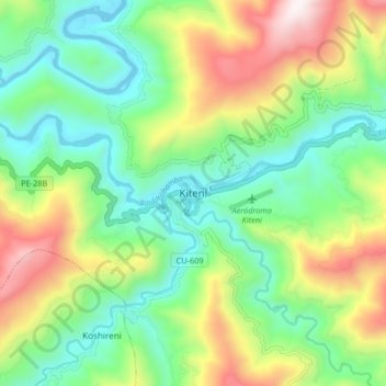
Name: Kiteni topographic map, elevation, terrain.

Location: Kiteni, Echarate, Province of La Convención, Cusco, Peru (-12.68723 -73.08875 -12.60723 -73.00875)

Average elevation: 935 m

Minimum elevation: 540 m

Maximum elevation: 1,687 m

Gear up for your next adventure:

🎒Backpack Rain Covers - Universal waterproof covers to protect your gear from downpours
🔦LED Camping Lanterns - Illumination for reading maps inside your tent at night
🔪Outdoor Multi-Tools - Versatile tools for gear repairs and food prep in the wild
📐Altimeters & Barometers - Tools for measuring altitude and air pressure
🌦️Portable Weather Meters - Handheld tools for monitoring weather conditions

As an Amazon Associate, this site earns from qualifying purchases at no extra cost to you.