Geolocate

Brallo topographic map

Click on the map to display elevation.

About this map
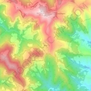
Name: Brallo topographic map, elevation, terrain.

Location: Brallo, Serole, Asti, Piemonte, Italia (44.52784 8.24599 44.56784 8.28599)

Average elevation: 571 m

Minimum elevation: 294 m

Maximum elevation: 840 m

Gear up for your next adventure:

🦟Anti-Midge & Tick Repellent - Vital for hiking in the Scottish Highlands during summer
🔭Compact Hiking Binoculars - Lightweight optics for scouting terrain and spotting wildlife
🗺️Topographic Maps - Detailed maps showing elevation and terrain features
🔪Outdoor Multi-Tools - Versatile tools for gear repairs and food prep in the wild
🥾Trekking Poles - Poles to improve stability on uneven terrain

As an Amazon Associate, this site earns from qualifying purchases at no extra cost to you.