
Suðureyri topographic map
Interactive map
Click on the map to display elevation.
About this map
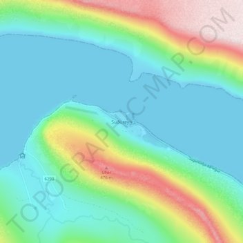
Name: Suðureyri topographic map, elevation, terrain.
Location: Suðureyri, Ísafjarðarbær, Westfjords, 430, Iceland (66.10957 -23.54678 66.14957 -23.50678)
Average elevation: 144 m
Minimum elevation: -1 m
Maximum elevation: 557 m
Other topographic maps
Click on a map to view its topography, its elevation and its terrain.