Geolocate

Devils Knob topographic map

Click on the map to display elevation.

About this map

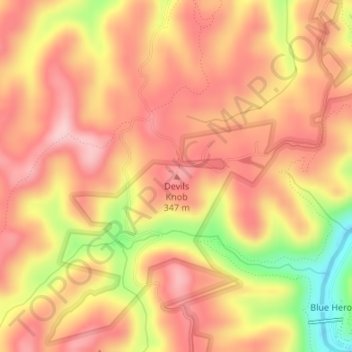
Name: Devils Knob topographic map, elevation, terrain.

Location: Devils Knob, McCreary County, Kentucky, United States (36.68125 -84.56287 36.68135 -84.56277)

Average elevation: 345 m

Minimum elevation: 219 m

Maximum elevation: 409 m

Other topographic maps

Click on a map to view its topography, its elevation and its terrain.

Pine Knot

United States > Kentucky > McCreary County

Average elevation: 399 m

Whitley City

United States > Kentucky > McCreary County

Average elevation: 390 m

Gear up for your next adventure:

🛌Insulated Sleeping Mats - Crucial thermal protection when sleeping on cold, uneven ground
🧣Neck Gaiters - Protects against wind and sun on exposed ridges and peaks
Lightweight Tents - Compact tents for backpacking and trekking
🔥Emergency Fire Starters - Reliable ignition tools for survival situations in damp conditions
🧘Folding Sit Mats - Dry and warm seat for map-reading breaks on damp ground

As an Amazon Associate, this site earns from qualifying purchases at no extra cost to you.