Geolocate

Nannerch topographic map

Click on the map to display elevation.

About this map

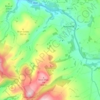
Name: Nannerch topographic map, elevation, terrain.

Location: Nannerch, Flintshire, Wales, United Kingdom (53.18199 -3.30052 53.22845 -3.23304)

Average elevation: 232 m

Minimum elevation: 110 m

Maximum elevation: 446 m

Flintshire trails, hiking, mountain biking, running and outdoor activities

Gear up for your next adventure:

🥤Hiking Water Bottles - Reusable bottles for hydration on the trail
📷Camera Straps - Secure straps for carrying cameras while walking
🔦Waterproof LED Headlamps - Hands-free lighting for evening treks and emergency navigation
🔋Lithium AA Batteries - Long-lasting power that performs well in cold mountain weather
🔋Power Banks - Portable chargers for long outdoor trips

As an Amazon Associate, this site earns from qualifying purchases at no extra cost to you.