
Samdrup Jongkhar District topographic map
Interactive map
Click on the map to display elevation.
About this map
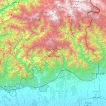
Name: Samdrup Jongkhar District topographic map, elevation, terrain.
Location: Samdrup Jongkhar District, Bhutan (26.79207 91.39227 27.24121 92.12135)
Average elevation: 1,350 m
Minimum elevation: 52 m
Maximum elevation: 4,468 m