
Goreme topographic map
Interactive map
Click on the map to display elevation.
About this map
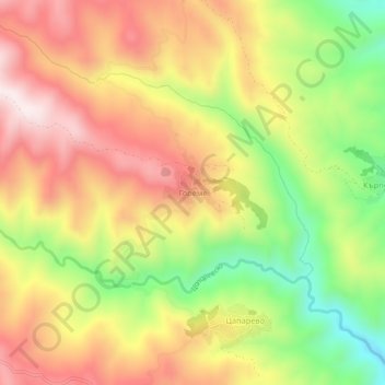
Name: Goreme topographic map, elevation, terrain.
Location: Goreme, Strumiani, Blagoevgrad, 2834, Bulgaria (41.62121 23.07062 41.66121 23.11062)
Average elevation: 747 m
Minimum elevation: 435 m
Maximum elevation: 1,034 m