
Thank you for supporting this site ❤️
Make a donation
Make a donation
Gear up for your next adventure:
As an Amazon Associate, this site earns from qualifying purchases at no extra cost to you.
Comuna 1 topographic map
Click on the map to display elevation.
Thank you for supporting this site ❤️
Make a donation
Make a donation
Gear up for your next adventure:
As an Amazon Associate, this site earns from qualifying purchases at no extra cost to you.
About this map
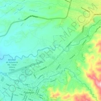
Name: Comuna 1 topographic map, elevation, terrain.
Location: Comuna 1, Popayán, Centro, Cauca, Pacífica, Colombia (2.44588 -76.62767 2.48045 -76.57703)
Average elevation: 1,760 m
Minimum elevation: 1,686 m
Maximum elevation: 1,946 m
Thank you for supporting this site ❤️
Make a donation
Make a donation
Gear up for your next adventure:
As an Amazon Associate, this site earns from qualifying purchases at no extra cost to you.
Other topographic maps
Click on a map to view its topography, its elevation and its terrain.
Reserva Natural de la Sociedad Civil El Palmichal
Average elevation: 2,576 m