
Chart Sutton topographic map
Click on the map to display elevation.
About this map
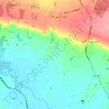
Name: Chart Sutton topographic map, elevation, terrain.
Location: Chart Sutton, Maidstone, Kent, England, United Kingdom (51.18298 0.54950 51.23116 0.58706)
Average elevation: 54 m
Minimum elevation: 13 m
Maximum elevation: 135 m
Kent trails, hiking, mountain biking, running and outdoor activities